Location: New York City, New Jersey
Technologies: Multibeam Sonar, Mobile LiDAR
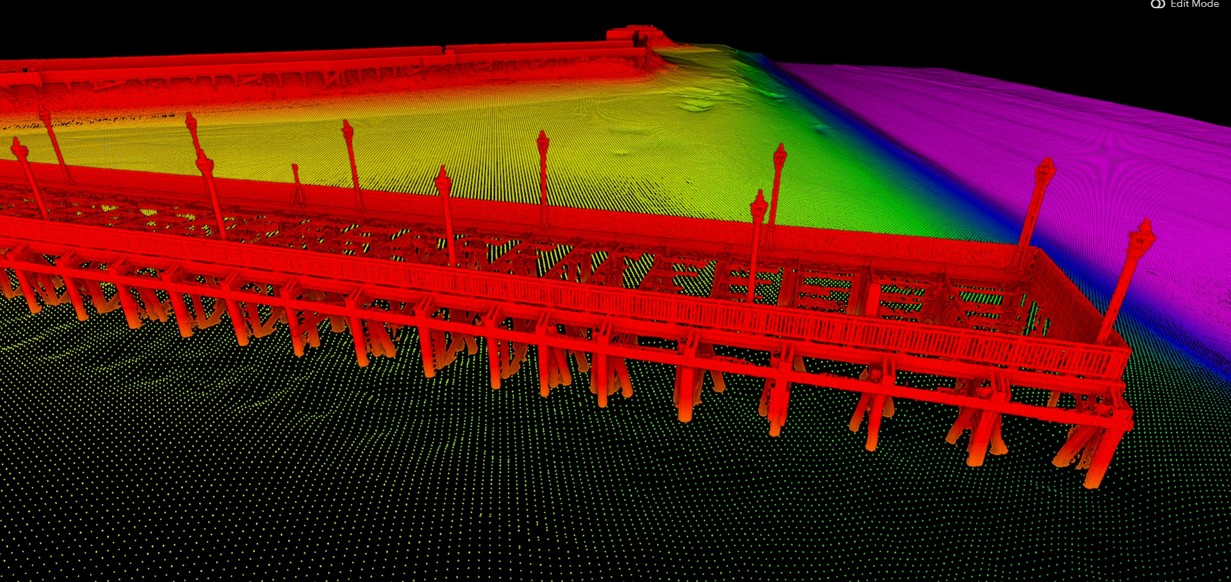
PROJECT SUMMARY
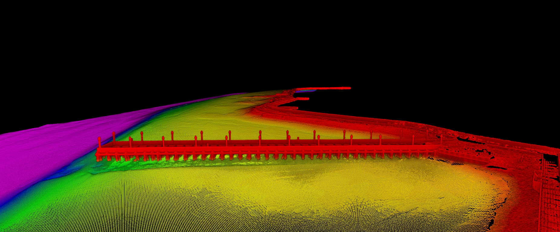
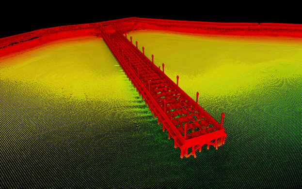
Seaworks performed a detailed bathymetric and shoreline survey on the Arthur Kill channel between New Jersey and Staten Island, NY to support remedial design work for an environmental project. Hydrographic surveying was performed using full-coverage multibeam sonar with the sonar head angled for full coverage up to the waterline along the bank. Next, a vessel-mounted mobile LiDAR system was used to collect high-resolution laser scan data of the shoreline as well as a pier structure. In limited shallow water locations, single-beam sonar was used to fill in where multibeam was ineffective.
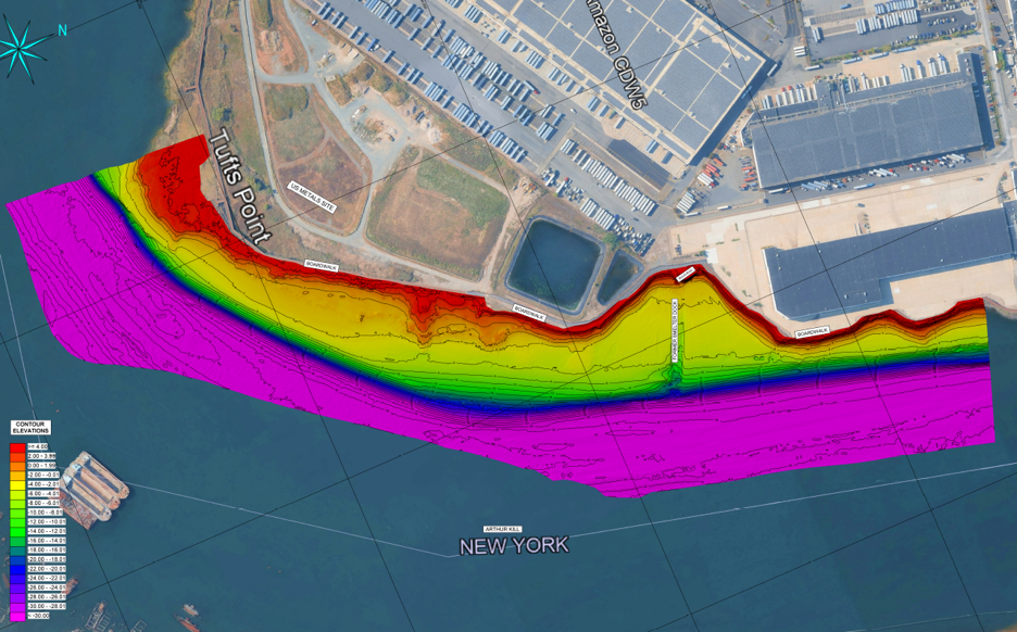
Cleaned, processed datasets were merged to compile a seamless surface model, as well as a full resolution 3D visualization of structures and shoreline. Deliverables included contour plots, TIN models, and point cloud data shared with the client in a user-friendly web interface, which allows Client to pan, zoom, rotate, and measure objects.